Warm air that has been hanging over the Midwest is about to be replaced by a blast of Arctic wind. Forecast models show a sharp drop in temperatures as a strong cold front moves through. In many places, daytime highs could fall more than 30 degrees in just one day. Winds will pick up, and heavy snow bands are expected to form around the Great Lakes, turning what might have been a normal winter cooldown into a dramatic national freeze.
Late Sunday into Monday, this fast-moving cold front will sweep across the region, changing mild weather into below-freezing conditions almost overnight. Light snow and bursts of snow squalls are likely in parts of the Great Lakes and the Ohio Valley, cutting visibility and making roads slick. Forecasters say this is just the first wave of a larger Arctic outbreak that could bring even colder air later in the week.
How the Arctic Air Escaped
Meteorologists trace this outbreak to disturbances high in the atmosphere. A shift in what are known as Rossby waves, large atmospheric currents that help steer weather patterns, has opened the door for cold Arctic air from Canada to spill south into the United States. When these air flows wobble, they can push frigid air into the mid-latitudes, especially during late December, when the atmosphere is already unstable.
This pattern has become more common during recent holiday seasons, raising the potential for several rounds of cold air rather than a quick cold snap. The Midwest and Northeast appear especially vulnerable to multiple waves of Arctic air. Each wave keeps temperatures low and increases the chances of ongoing snow and ice, extending winter conditions across much of the country well into the new year.
Trouble for Holiday Travelers

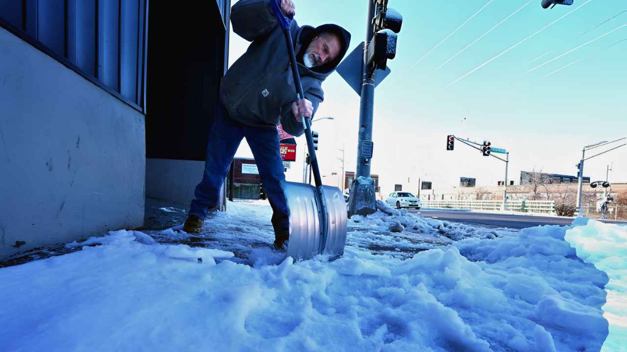
Timing couldn’t be worse. Millions of people traveling for New Year’s will face cold temperatures, snow squalls, and strong winds. As the front passes, pressure changes in the atmosphere may send gusts across highways and airports, adding another challenge for travelers. In some cities, temperatures will drop more than 30 degrees in just 24 hours. For example, Indianapolis is expected to fall from the low 60s on Sunday to the mid-20s by Monday.
The sudden shift will make it feel even colder than the numbers suggest. Wind chills could dip 20 degrees below actual temperatures, bringing a real risk of frostbite for anyone stranded outdoors. Interstates may close temporarily, flights could face delays, and local travel might grind to a halt under blowing snow and whiteout conditions. Emergency crews are already preparing for dangerous driving conditions, especially across the Great Lakes, Ohio Valley, and interior Northeast.
As the Arctic air spreads eastward, the Northeast will see highs in the 20s and 30s by Tuesday. Even coastal cities will feel the freeze as icy conditions develop on sidewalks and roads. In rural areas, power lines and trees will struggle under the weight of snow and strong winds. The cold will not be isolated to one region, it’s expected to stretch from the Upper Midwest to the East Coast.
Bracing for a Long Freeze
The bitter cold shows no sign of letting up quickly. Another blast of Arctic air is expected right after New Year’s, keeping much of the country frozen through early January. High temperatures could stay in the teens across the Upper Midwest, while wind chills drop below zero. Even the Southeast might experience freezing nights as far south as northern Georgia and Alabama.
Meteorologists say this extended freeze may be linked to disruptions in the polar vortex—a circulation of cold air high above the Arctic. When the vortex weakens or shifts, it allows much colder air to escape into North America, setting the stage for deep, prolonged winter conditions.
Local and state agencies are rolling out emergency winter measures. Snowplows are being deployed, warming centers are opening for those without heat, and road crews are pretreating highways before ice forms. Utility companies are also reinforcing power grids to handle increased energy demand.
AccuWeather’s lead long-range forecaster, Paul Pastelok, advises residents to prepare early. He warns that the combination of strong winds, lake-effect snow, and plunging temperatures will stretch across the Great Lakes, Ohio Valley, and interior Northeast. While some forecasts hint at a possible thaw after New Year’s, most experts agree that the cold will stay put east of the Rockies for at least the first week of 2026.
As the new year arrives, millions of Americans will be watching the skies and the thermometers, wondering how long the Arctic grip will last, and whether this deep freeze will come to define the start of winter 2026.
Sources:
“Arctic blast to bring multiple waves of dangerous cold to the Midwest and Northeast.” AccuWeather, 25 Dec 2025.
“Chill out: Arctic blast on the way for the new year.” USA Today, 26 Dec 2025.
“Latest forecasts show a surprising Cold return over the U.S. and Canada.” Severe Weather Europe, 23 Dec 2025.
“Strong system Sunday with record high potential, much colder by Monday.” WISH-TV, 26 Dec 2025.