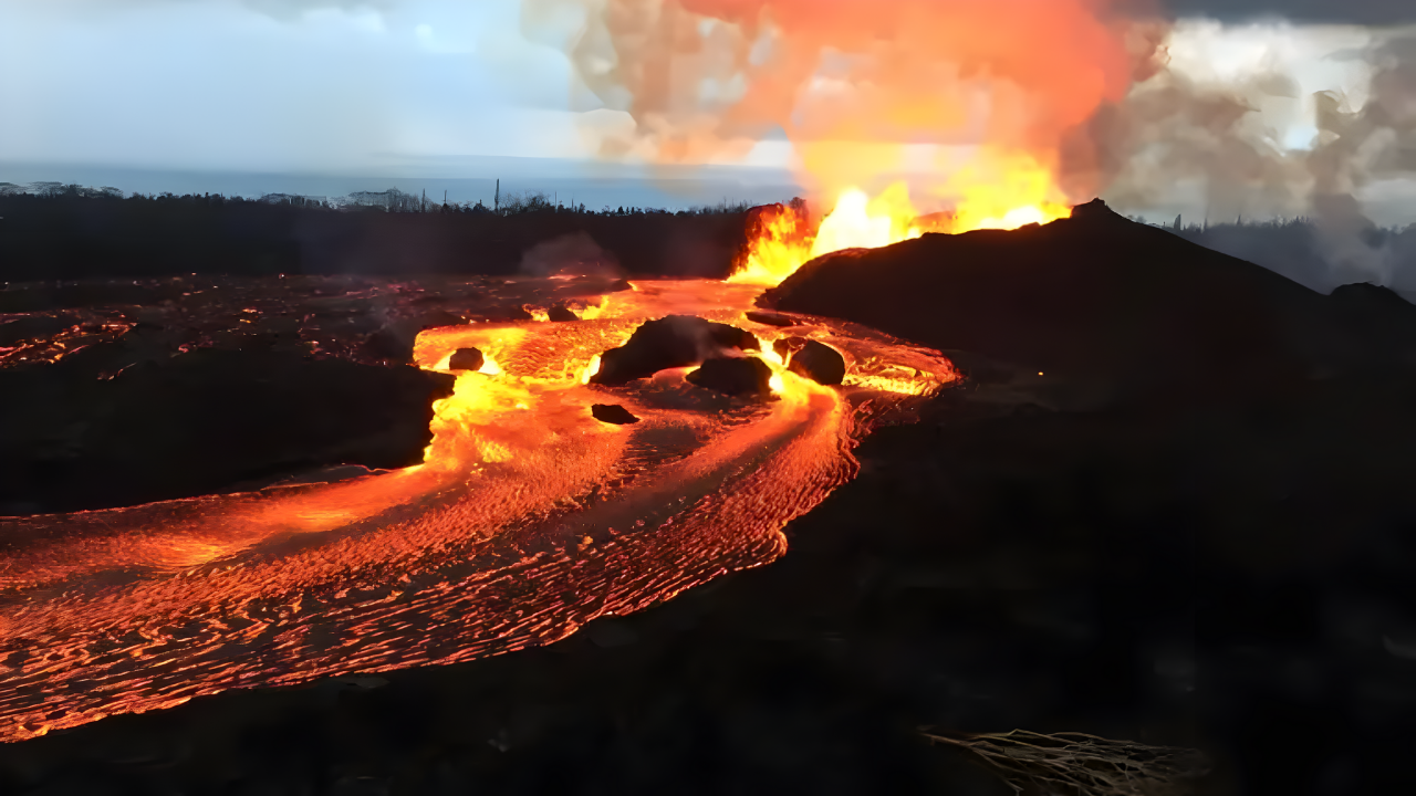
On a single day in November 2025, emergency managers across Washington state were inundated with calls about an eruption at Mount Rainier that was not happening. Viral online posts and sensational headlines claimed the volcano was in a “72-hour tremor phase” with a “95% chance” of a major eruption. None of it was true. Within hours, seismologists traced the supposed crisis to something far more mundane: ice building up on a monitoring antenna, distorting the data feed and fueling a global misinformation scare.
Mount Rainier had been active earlier in the year, but in a very different way. In July 2025, the volcano went through its most vigorous seismic episode since modern monitoring began, drawing close attention from scientists but not triggering any alert level changes. Months later, that real event became raw material for manufactured alarm, as misleading interpretations and fabricated statistics spread faster than official corrections could catch up.
Seismic Unrest Without Magma

The July swarm began on July 8, 2025, when instruments around Mount Rainier detected an abrupt increase in small earthquakes beneath the summit area. Over the following weeks, seismologists located more than 1,350 individual quakes, with thousands of additional signals too small to precisely characterize. At peak intensity, the swarm produced around 40 earthquakes an hour.
Detailed analysis pointed to hydrothermal circulation—hot water and steam moving through fractures in the rock—rather than magma rising toward the surface. The largest event reached magnitude 2.4, far below the level most people can feel, and the tremors clustered at an average depth of about 2.8 miles beneath the summit. Gas measurements and surface deformation remained normal.
Harold Tobin, director of the Pacific Northwest Seismic Network (PNSN), described it as the most energetic swarm yet recorded at Mount Rainier, but stressed that there was no sign of unusual magma movement. For researchers, the sequence offered a rare window into how fluids move within a large, glacier-clad volcano. For the public, however, the nuance of hydrothermal versus magmatic activity would later be lost amid more dramatic claims.
From Data Glitch to Global Scare

In mid-November, several international outlets and online channels published alarming stories that repackaged Mount Rainier’s July seismicity as an ongoing emergency. Headlines spoke of an “unprecedented 72-hour tremor phase” and an escalating “eruption threat.” Some videos and posts falsely attributed to NASA or the U.S. Geological Survey (USGS) a “95% eruption probability” for the volcano.
These assertions did not match anything in official bulletins or scientific literature. PNSN scientists quickly reviewed real-time data from Rainier’s instruments and found no unusual activity at all. Instead, they traced the odd signals that had been highlighted online to ice accumulation on a monitoring antenna, not to any change inside the mountain.
Doug Gibbons of PNSN stated there was “absolutely no cause for alarm,” emphasizing that earthquake rates on the volcano were at background levels. At the same time, USGS maintained Mount Rainier’s status at GREEN, the lowest tier in its four-level alert system that ranges from GREEN (normal) to RED (alert). As of December 10, 2025, there had been no discussion among federal scientists of raising the volcano to advisory status.
Experts also rejected the widely circulated “95% eruption probability” figure. That number does not appear in any USGS communications about Mount Rainier and may instead have originated from risk discussions about a different volcano in Italy. Regardless of its origin, it was incorrectly applied to Rainier and used to generate attention-grabbing portrayals of imminent disaster.
Lahars: The Quiet, Persistent Danger

Behind the false alarms lies a more complicated reality: Mount Rainier is one of the most hazardous volcanoes in the United States, but not primarily because of explosive eruptions. Its greatest risk comes from lahars, fast-moving slurry flows of mud, water, volcanic debris, and rock that can race down valleys at highway speeds.
Rainier holds 26 major glaciers and roughly 34 square miles of permanent snow and ice—more than all other Cascade Range volcanoes combined. This vast frozen reservoir can rapidly melt or collapse during certain types of eruptions or flank failures, transforming into powerful debris flows. Modeling shows that some lahars could reach nearby communities in about 40 minutes, with more distant towns in downstream river valleys also at risk.
The USGS National Volcanic Threat Assessment ranks Mount Rainier as the third most dangerous volcano in the country, after Kīlauea in Hawaii and Mount St. Helens in Washington. The ranking reflects potential future impact—taking into account population exposure, infrastructure, and likely hazards—rather than past fatalities. Kīlauea and Mount St. Helens have both killed dozens in historical events. Rainier’s last known eruption was in the late 19th century, but geological evidence shows it has produced large lahars that reached the Puget Sound lowlands in the 1800s and earlier.
Preparedness, Not Panic
Authorities around Mount Rainier have spent years planning for these long-term risks. Pierce County and other jurisdictions maintain detailed lahar response plans, including evacuation routes and public education efforts. Schools located in mapped lahar zones conduct regular drills; in 2024, tens of thousands of students practiced evacuating on foot to high ground outside projected flow paths.
A dedicated lahar early warning system uses acoustic sensors to detect the vibrations of fast-moving debris flows in river channels and trigger alerts downstream. Emergency managers coordinate closely with USGS and PNSN scientists, who operate an extensive network of seismometers, GPS stations, infrasound detectors, cameras, gas samplers, and thermal sensors around the volcano. This integrated system allows researchers to distinguish between routine hydrothermal unrest and the clearer seismic, deformation, and gas signatures associated with magma rising.
Mount Rainier’s eruptive history indicates the volcano remains capable of future activity. Over the past half-million years, it has produced large debris flows or eruptions roughly every 500 to 1,000 years, though intervals vary and do not operate on a fixed schedule. Smaller events continued sporadically into the 1890s. Scientists stress that “capable of eruption” does not mean “about to erupt,” and that any genuine change toward magmatic unrest would be accompanied by a pattern of signals quite different from those seen in July’s hydrothermal swarm.
Science, Sensationalism, and the Next Alarm

The 2025 Mount Rainier scare highlights how genuine geological events can be reshaped into misleading narratives in the era of algorithm-driven feeds and AI-generated writing. Real data from a significant but non-magmatic swarm, combined with a later instrumentation glitch, were blended with unfounded statistics and dramatic language to create a misleading impression of imminent catastrophe.
Researchers caution that such episodes can erode public trust and complicate emergency communication when a real crisis does emerge. They urge residents to rely on primary scientific sources—such as the USGS Cascades Volcano Observatory, the Pacific Northwest Seismic Network, and local emergency management agencies—for updates on volcanic conditions. For communities living in lahar hazard zones, the lesson is to remain informed and prepared without succumbing to viral panic. As monitoring technology and communication tools continue to evolve, the central challenge will be ensuring that accurate, measured assessments stay visible enough to guide public understanding when the next surge of seismic noise, or digital noise, arrives.
Sources
USGS Cascades Volcano Observatory volcanic activity reports and alerts, July-December 2025
Pacific Northwest Seismic Network earthquake data and official statements, July-November 2025
USGS National Volcanic Threat Assessment; Mount Rainier lahar hazard zone documentation
CNN volcano science reporting and geological hazard analysis
Pierce County Emergency Management lahar preparedness and evacuation protocols