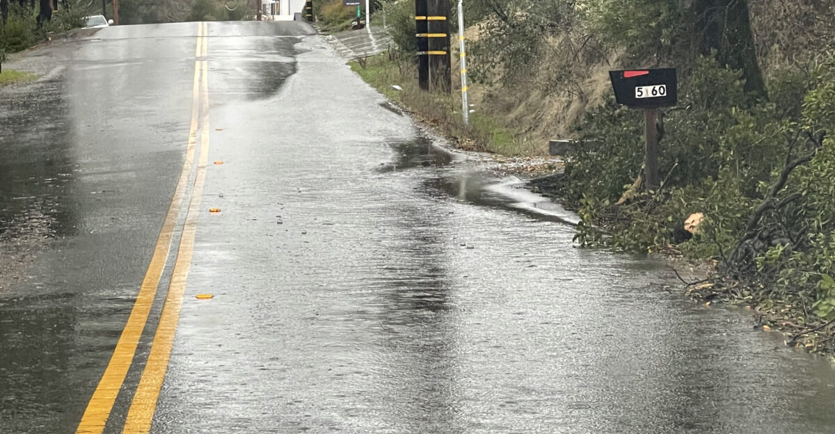
Heavy rain is flooding highways in Northern California. Water surged over roads, trapping cars and killing at least one person near Redding. That area got almost five inches of rain in just 24 hours. Rescue teams saved drivers from cars underwater. Forecasters warn of bigger dangers from two back-to-back atmospheric rivers. These storms threaten 30 million people, mostly in California, right before Christmas.
All of California is under a flood watch. Normal seasonal rains have turned into a statewide emergency. The ground is soaked and can’t hold more water. This puts extra pressure on rivers, creeks, and city drains. Holiday travel makes it hard to leave homes safely. Businesses are closed, and houses are full of family. A second storm is coming before the first one ends. This makes the risks even worse.
Rare High-Level Warnings Issued
The National Weather Service gave its top warning: Level 4 for excessive rain. This rare alert happens on fewer than 4% of days. But it causes over 80% of U.S. flood damage. About 36% of flood deaths link to these warnings. Right now, over 5 million people face this highest level. It’s one of the worst in California for years.
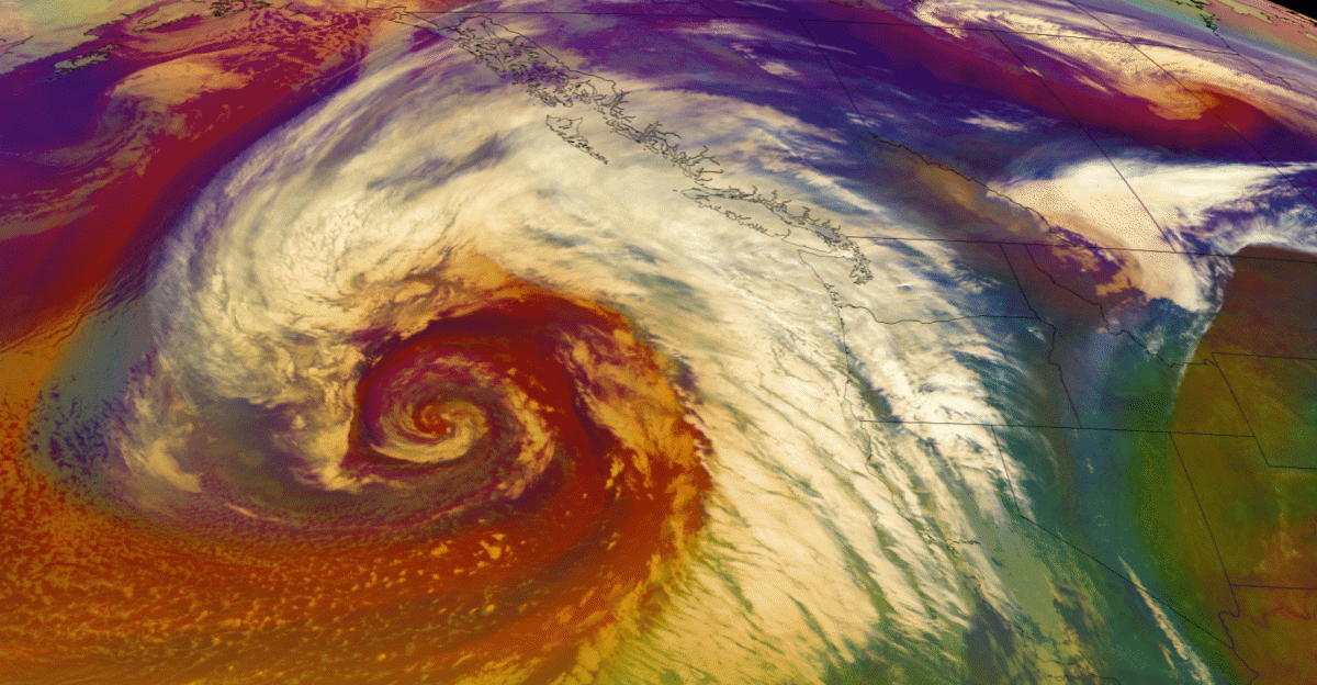
These atmospheric rivers are like narrow bands of moisture from the Pacific Ocean. Warm ocean water fuels them. The first one hit Northern California hard. The second one follows right behind. There’s no time to recover. This piles up rain in mountains and valleys.
Soils across the state are waterlogged from recent storms. Streams are swollen, and hillsides could slide. Rain now runs off the surface instead of soaking in. This is especially true near burn scars from wildfires. Scorched ground acts like concrete and pushes water away. Flood watches last through Friday. Even light rain could cause flash floods.
Southern California Faces Major Surge
Southern California is in the spotlight now. Level 4 alerts cover parts of Los Angeles, San Bernardino, and Santa Barbara counties. Another 13 million people are under Level 3 risk. The storm targets Tuesday night through Wednesday. Coastal and valley areas could get 4 to 8 inches of rain. Foothills and mountains might see 8 to 12 inches by Saturday. That’s like two months of rain for Los Angeles in just one week. This raises the odds of flash floods, washed-out roads, and landslides.
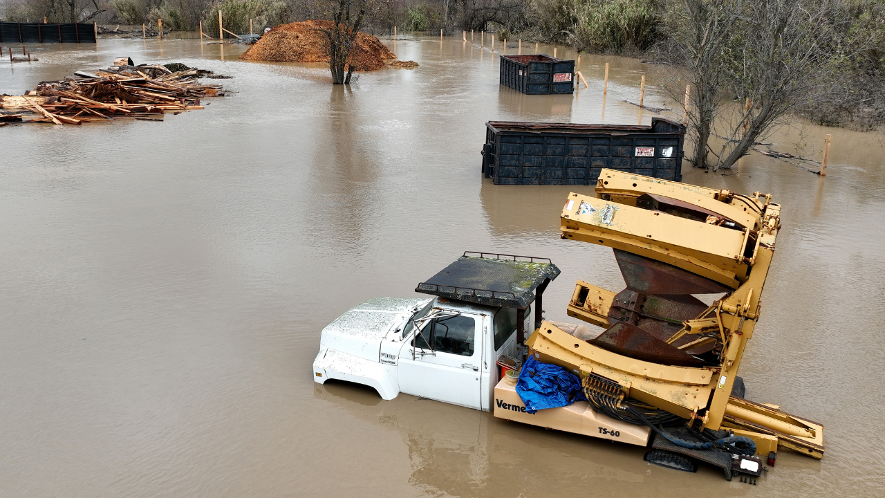
Los Angeles County ordered people to leave 383 homes in burn-scar areas. These include Eaton, Palisades, Hurst, and Kenneth zones. Wildfires there destroyed 16,246 buildings. Deputies went door-to-door to warn residents. They fear sudden debris flows. Up north, one person died in a flooded car near Redding. Humboldt County had water chest-deep. Rescuers used boats and jet skis in Sonoma, Shasta, and Placer counties. Interstate 5 closed due to debris and washouts.
Burn scars make things worse. Without plants, water races down hills carrying mud, rocks, and junk. Mudslides can hit fast, even after the main rain stops. This is a second disaster for wildfire survivors. At the same time, the Sierra Nevada mountains are getting buried in heavy snow. Mountain passes are shut, leaving some areas cut off. Warmer storms push snow higher up, flooding low areas while covering peaks.
Second Storm Looms with Urgent Warnings
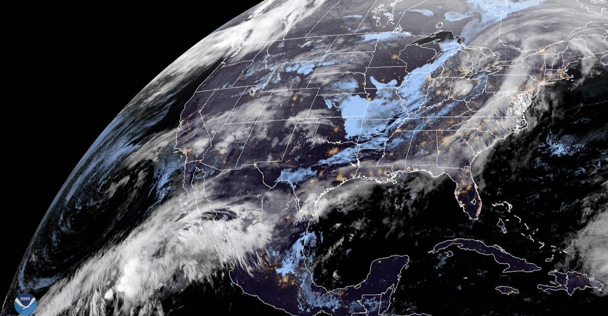
A second atmospheric river will strike Thursday through Friday. It targets areas already hit hard. Officials call it a long attack on 30 million people under alerts. The National Weather Service in Los Angeles said: “START TAKING PROTECTIVE ACTIONS NOW.” People are filling sandbags, heading to shelters, and canceling trips as Christmas Eve nears.
State and local leaders turned on emergency help. They focus on burn-scar zones first. Cleanup teams are clearing debris from Interstate 5 before the next storm. Schools are closed. Shelters have opened. Utility companies brace for power outages.
With these rare alerts, soaked ground, and storms one after another during holiday time, one death is confirmed. Eighteen million people face high flood risk. California’s safety depends on quick action and following warnings. How well people prepare will show in the final results.
Sources
CNN – Rare ‘high risk’ for flooding spurs evacuations in Southern California – December 22, 2025
National Weather Service Los Angeles/Oxnard – Area Forecast Discussion – December 22, 2025
NBC News – 1 killed in California as heavy rain and flooding threaten parts of state over holidays – December 22, 2025
Los Angeles Times – Biggest Christmas storm in years set to hit SoCal: Timeline for the week – December 21, 2025
Center for Western Weather and Water Extremes (CW3E) – CW3E AR Update: 22 December 2025 Outlook – December 21, 2025