Picture this: millions of Americans woke on December 28 to a sky that would change everything. A monster storm, technically called a “bomb cyclone,” was barreling toward the Midwest with one mission: chaos. Within 24 hours, this rapidly intensifying weather system would trigger the largest winter emergency response since the holidays began, closing interstate highways, grounding thousands of flights, and forcing governors to activate National Guard units. Here is how it unfolded.
A Monster Storm Builds Fast
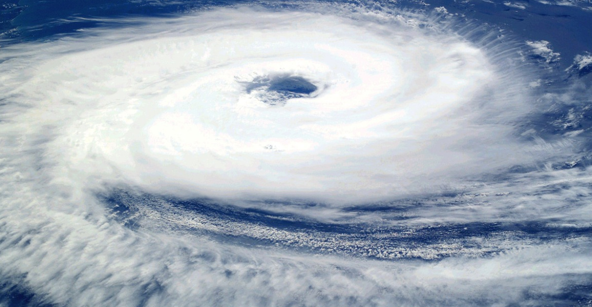
Sunday morning seemed ordinary across the Upper Midwest, but meteorologists knew better. A rapidly intensifying low-pressure system, officially a bomb cyclone, gathered strength over the Great Lakes with explosive intensity. It met bombogenesis criteria as pressure dropped at least 24 millibars within 24 hours. What made it different was timing, geography, and peak holiday travel vulnerability. Yet the term itself still needed decoding.
So What Is Bombogenesis?
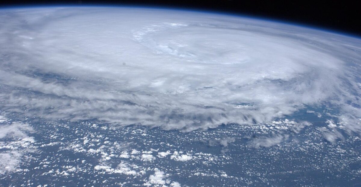
Meteorologists are not being dramatic when they use the term “bomb.” NOAA’s National Ocean Service says bombogenesis occurs when “a midlatitude cyclone rapidly intensifies, dropping at least 24 millibars over 24 hours,” cited on October 21, 2025. Cold air collides with warm air, steepening the pressure gradient and generating hurricane-force winds. This December storm did exactly that, and the setup was already primed.
The Collision That Lit The Fuse
By Saturday, December 27, the pieces were falling into place. Arctic air racing southeast from Canada met lingering warmth across the South, a 50-degree contrast that created an explosive collision. The jet stream steered it toward the Upper Midwest and Great Lakes, while pressure plunged toward 978 millibars. “Forecasters expect the storm to intensify in the coming days, propelled by the clash of cold Canadian air and the warmth of the southern U.S..” The first warnings soon followed.
Millions Realize They’re In The Path
By Sunday afternoon, the threat had turned into official alerts. Nearly 64 million Americans were under some form of winter weather warning, with over 8 million under winter storm warnings and nearly 2 million under blizzard warnings. In Minnesota, Governor Tim Walz faced peak travel colliding with impossible roads. Interstate 35, the region’s key corridor, was about to become a dangerous bottleneck. Would officials shut it down?
I-35 Goes Dark In Both States

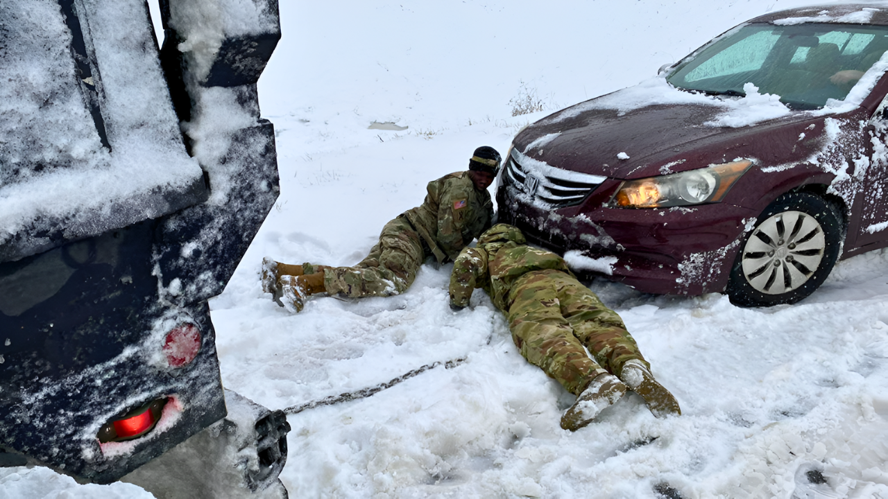
Sunday afternoon brought the decision no one wanted: close Interstate 35 from Albert Lea, Minnesota, south to Ames, Iowa, more than 200 miles. Hundreds of crashes were already piling up. Freeborn County officials urgently requested the National Guard. Jackknifed semis, stranded cars, and near-zero visibility signaled full-blizzard conditions. The closure stayed through Monday morning, but the state response escalated even faster.
Walz Declares Emergency And Mobilizes
On Sunday afternoon, Governor Tim Walz declared a peacetime emergency and authorized the Minnesota National Guard to support operations. “During a time of peak holiday travel, the winter weather moving across the state poses a major risk for anyone on the roads,” Walz said on December 28, 2025. Over 13,000 soldiers and airmen stood ready, including tracked vehicles for rescues. The storm then began writing its totals.
Snow Totals Turn Into Records
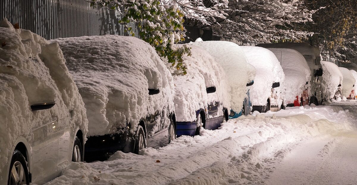
As Sunday night turned to Monday, snowfall totals showed the storm’s intensity. Michigan’s Upper Peninsula saw 27.5 inches at Mount Arvon, nearly 2 feet in Marquette, 20 inches in Gile, Wisconsin, and 26 inches in Lysander, New York. Syracuse logged 24.2 inches on Tuesday, breaking a daily record and marking its second-snowiest day ever. But snow was not the strangest headline.
Lake Erie Suddenly Drains In Ohio
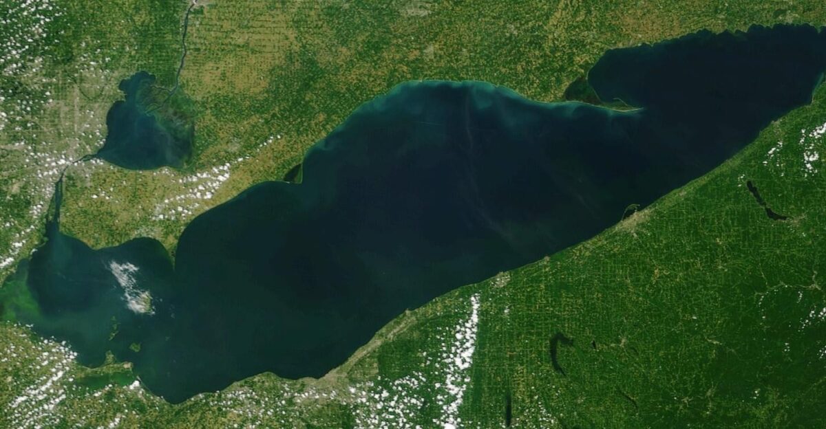
While snow hammered the Midwest, something surreal happened on Lake Erie. Southwest winds gusting up to 60 mph pushed the lake toward Buffalo, New York. In Toledo and Oregon, Ohio, a lakebed appeared as a seiche sloshed water across the basin. People walked where it usually is 12 feet underwater, spotting 1830s pier pilings. Meanwhile, Buffalo faced flooding as about 7 feet of water piled up. How strong did winds get elsewhere?
Wind Speeds Push Into The Extreme

The winds were relentless and dangerous. Gusts exceeded 45 mph across the region, with some areas seeing sustained hurricane-force intensity. Buffalo recorded a 79 mph gust, according to an AccuWeather meteorologist reporting on December 31, 2025. In North Dakota, wind chills hit minus 30 degrees Fahrenheit, with frostbite possible in 15 minutes. Trees and power lines fell, creating fresh hazards. Travel systems soon felt the full impact.
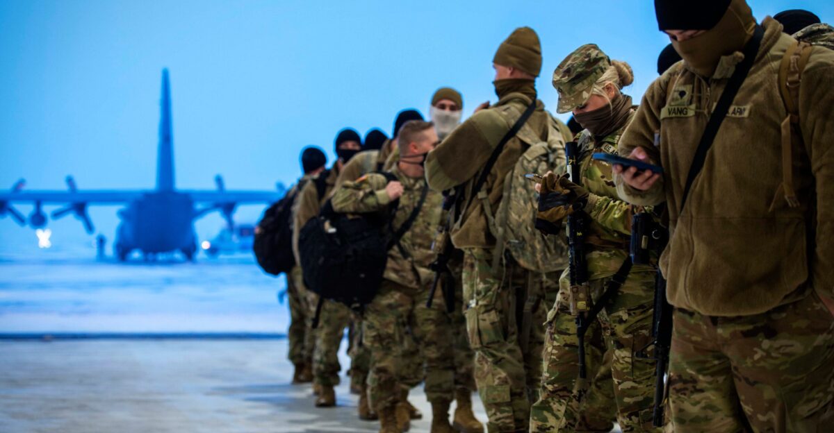
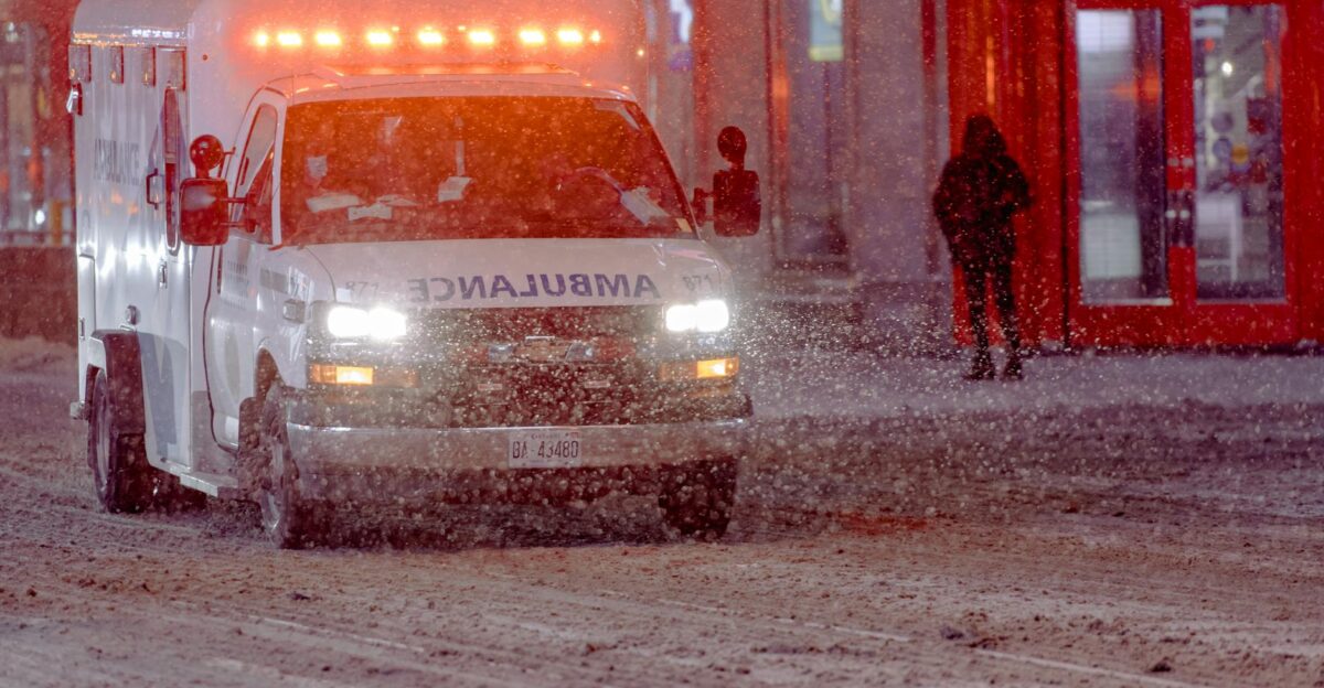
Guard Units Activate Beyond Minnesota

Minnesota was not the only state calling in military help. New York activated 460 National Guard soldiers and airmen on December 27, pre-positioning resources before travel became impossible. Colorado Governor Jared Polis activated about 50 soldiers with tracked vehicles for extreme conditions. These were tactical missions: extracting stranded motorists and supporting shelters. Past bomb cyclone responses had rescued dozens of people. Then crash numbers began coming in.
Crash Counts Spiral Across Multiple States

Monday morning brought grim road totals. Minnesota State Patrol logged hundreds of crashes by 11:30 a.m., including 186 property damage crashes, 16 injury crashes, 25 spinouts, 148 vehicles off the road, and 17 jackknifed semis from midnight to 11:30 a.m. Vermont police handled 92 crashes overnight with 3 injuries. Iowa reported dozens, including at least 1 fatality. How did temperatures change so fast?
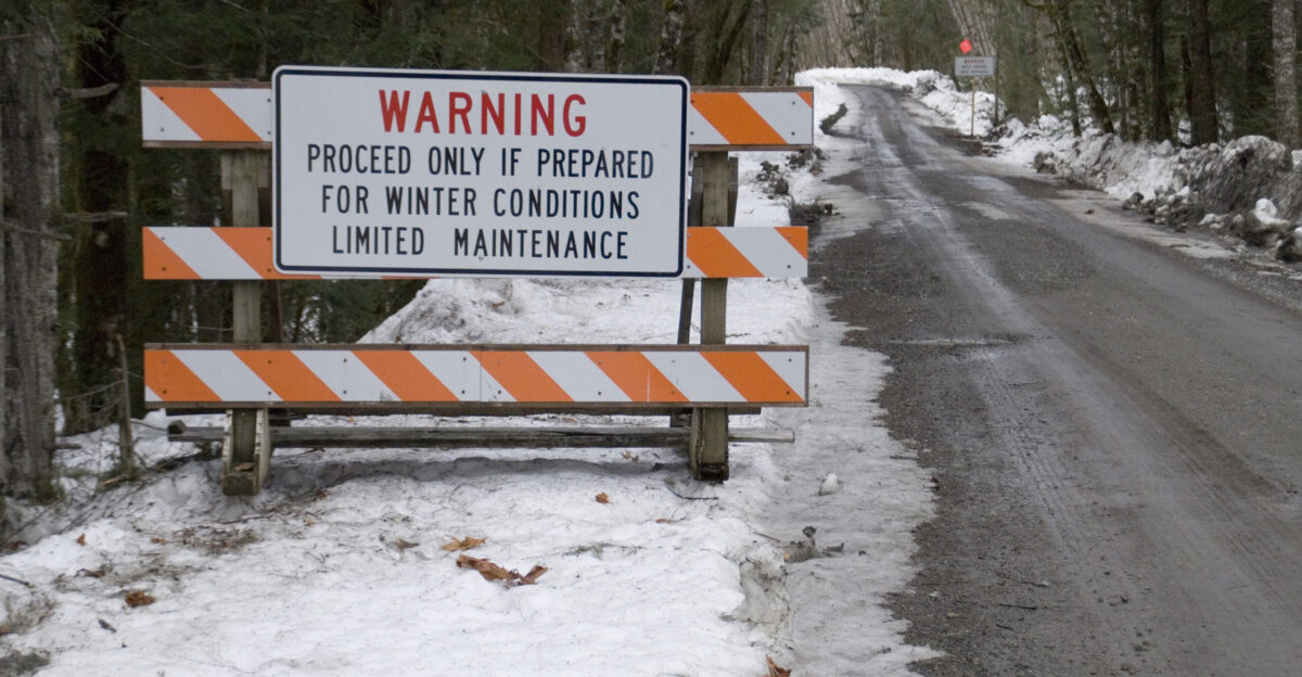
Warnings Say Travel Becomes “Impossible”

Blizzard warnings, the most severe winter alert short of a winter storm emergency, covered huge areas. Heavy snow combined with 40-65 mph winds produced near-zero visibility Sunday night into Monday, according to National Weather Service documentation issued December 28, 2025. The warnings said travel would be “impossible” in blizzard zones. Drivers often could not see lanes or oncoming traffic. Guard soldiers later described seeing only a few feet. But another state faced its own crisis.
California Battles A Different Holiday Emergency
While the bomb cyclone hit the North, California faced separate winter disaster conditions. Governor Gavin Newsom declared a state of emergency for 6 counties on Christmas Eve as storms pounded the state, according to Xinhua reporting on December 25, 2025. At least 4 people were killed, with outages reaching 140,000 customers. A 23-meter tree fell in San Diego, killing a 64-year-old man. With blizzards in the Sierra, resources stretched thin. Was 2025 already beyond normal?
A Year Of Losses Adds Up Fast

The December bomb cyclone capped an extreme year for U.S. weather disasters. AccuWeather estimated 7 major weather disasters in 2025 caused $378 billion to $424 billion in total damage and economic loss. That equals about $378 billion to $424 billion in USD. The Los Angeles wildfires alone drove $250 billion to $275 billion in damages, while Hurricane Melissa added $48 billion to $52 billion. The bomb cyclone added billions more, hinting at a costly recovery ahead.
Roads Reopen, But The Risk Lingers

By early Monday, December 29, Iowa DOT reopened I-35. Minnesota followed, but warned that “as conditions improve, state and local agencies will continue to work through the morning of December 29 to remove disabled vehicles from traffic lanes,” in official statements. Northbound traffic had stayed open, but the southbound closure stranded hundreds Sunday. Crews found abandoned vehicles, evidence of evacuations and desperate escapes. The final lesson came from what worked, and what did not.
A Stress Test With Real Consequences
As the bomb cyclone moved into history books, America’s emergency response systems looked proven, and exposed. National Guard teams rescued stranded motorists. Road crews reopened key corridors faster than many expected. Utilities mobilized restoration teams, while hospitals and police handled surge demands under dangerous conditions. Yet vulnerabilities were clear: 4 deaths in California, multiple crash fatalities nationwide, and billions in damages. The storm showed preparedness helps, but nature still sets the terms.
Sources
Winter Storm and Blizzard of December 28-29, 2025. National Weather Service La Crosse Office, December 29, 2025
World’s Top 10 Extreme Weather Events in 2025. AccuWeather Severe Weather Analysis, December 30, 2025
What is bombogenesis? National Ocean Service NOAA, October 21, 2025
Governor Walz Authorizes Minnesota National Guard to Support Emergency Storm Operations. Governor Tim Walz Office, December 28, 2025
I-35 Southbound Reopens at Albert Lea. Iowa Department of Transportation, December 29, 2025